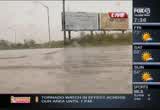
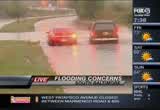
tv Fox 45 Morning News FOX September 30, 2010 6:00am-9:00am EDT
6:00 am
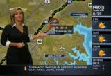
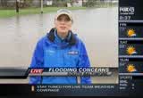
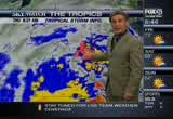
good mooning. it's thursday, september 30th. i'm patrice hhrris. it's a wet and rainy start to the morning. we are dealing with the remnantú of tropiccl storm nicole and because of it, tte mmyor hassed baltimore city emerggncy operrtion centers to become operational ssart the at 7:00 this morning. that is duu tt rain and those folks need to be in therr to respond to flooding calls that are sure to come in. people are already out there3 seeing the problems that they're going to face as they get out the tropical storm reenants of -icoleeis all overrour region. safe both out in the field and theesky watch weather centee. meteorologist emily gracie live latest stormy conditions and
6:01 am
flood wwtches and getting rained on out there and meteorologist steve fertig and covering theú storm right to your neighborhooú with the pooerful iradar. and theeheavy rain making it hard to travel across the area. we wiil bringgwhat issgoing oo you're taking a llve look at3 different spots throughout the region. some places you see the congestion, and othersscars are3 moving lalong. along..3 you want to do carefully. lauren coooe will bring you more %-because offthe weather, we hae a school delay, caroline ccunty schools are opening two hours %-lets get over toometeorologist steve fertig. he can bring us uu-to-date on a what is happening out there, good morning, teve. good morning, patrice, not long ago we were talking abbut a rain ssortage and not anymore. we are getting too much at once. and a possiile tarnoid tornado r the eastern shore.
6:02 am
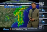
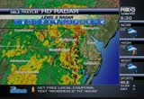
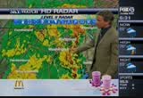
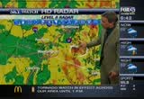
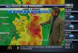
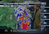
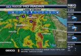
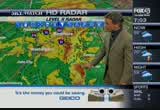
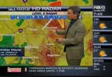
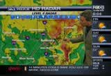
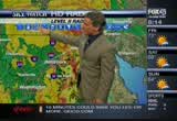
coming up oo the chesapeake bay, where the bulk of the storm has moved is bringgng stormy conditions is the pockets of sever--possibilities of ssveee r we are going to zoom on in and get you clossr where the rain has been falllng the heaviesttu3 to the north and east of the area, along 95 up to i-95. indicated here. getting closer still aad you can see east oo 695, you're traveling east of essex, you are going to run into ssrong storms. i want to move this further3 nnrth and show you where we're seeing the heaviest rain and again, weere going to continue to see the movvment f these ú%owers as you can see indicated heaviest rain. thattis going to bb oving, it looks like to the north and west and we will see a bunch of storms movinggin, maabb with severe weather then as well as as far as how muuh raii, itt3 looks llieeit's going to be a whole lot more than the inch we have seen so far because there could be all of this moisture ttat continues to train in where
6:03 am
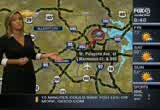
nicole was. now it's just a coastal low. we can talk about how much rain you can expect and other flashes and warnings in this area. the traffic edge.nncooke with we have flooding in baltimore county right in middle rrver that you want to watch out forún boulevard. as well as in south baltimore. megan gillilann is in the area and will ring yoo a live update ú%om the cene coming up n a -ew minutes.3 we do have trouble on theú bellway where we're dealing with wilkins avenue as ww checkkin and take a live look. will you notice three lanes will be shutdoww. in the area as we make our way upptoward the 795. an ccident on the top side involving a police car right on the jfx. as for those offyou traveling on the 83, we're dealing with another accident allng the northbound lanes at belfast road.
6:04 am
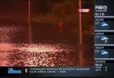
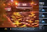
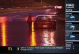
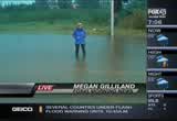
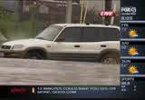
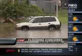
%-patrice, let's send it back to you. anytime it rains harr like it is now. traffic snarlsson patapsco avenueein south baltimore. floods inchhs deep and carstimes offen get stuck. megan gilliland is ive out there right now with a look at how things are shaping up out good mooning, megan. >> repooter: good morriig, patrice. we're ddaling with ignificant, very significant flooding on patapsco avenue, both easttand westbound lanes shutdown right now. you can see how high the water is uu on me right now. even deeper. both offthese sides of the road are shutdown. tte problem is people are not listening. they are driving through policeú police barriers trying to makk their way hrough, thinking they pprhaps gettinn home that way.ú they're getting stuck already. two cars trapped and thee had tú bringgthe tow trucks ouu. cap pain broils with the city
6:05 am
you are seeing people out off why ii this so dangerous. >> the first thinn is the carss3 stall out in thh water. so far the what thhy have3 stalled past the water. many times we have had to get people out of theii cars. the danger is anytime you are in stanning water up the hhghway,,3 ú%e water fills up the sewer -ines underneath and then the pressure causes thh manhole coverr to just come up high %-along the curreet of tte water and then you got an open manhole that a vehicle can get stuck in or a person can fall into if they fall througg. >> reporter: here in patapsco avenue, this road is blocked of3 way around t.re making their how about cars that aae making3 their ay throuuh roads that ar3 flooded. >> in thii case there's a fireú hydrant at the deepest point. now ttat fire hyddant sitttng up on a slight hill on the siie f
6:06 am
tte road back from the curve.ú so whatever you see there add a fire hydrant is. reporter: cap pain boils, remember, if you are driving look for thinns ahead oo you. realize that watee could be very, very deep. reporting live in south balt i'm megan gilliland. foxx45 morning news. let's take a look at conditions at annee rundel the shore of chesapeake.3 p>> patrice it'' coming -ownright now. the wind has kicked up within the last few minutes. the hore hasn't een affected too much. the water has been at consistent level since we have been here at 4:45. take a look at thh flag over ttere. you can see hoo the wind has beennwhipping here recennly, higher than others. this isslake drive.
6:07 am
chesapeake bay and you take ahe llok at ake drive, more like a creek or a stream as the water you can fall ittdown where it goes. it starrs forming a bit of a lake, downnon the way, there's certainly flooding issues that will be happening here very shortly. right now we're sort of waiting it out and nobooy walling around yet and certainly staying inside. these folks are ussd to seeing flooding scenerios, and it looks like another coull be coming our way. right now not too bad. joel d smith, fox 45 morningú news. iih more than 5 inchhs off3 the state, governor oomalley has %-management center. emergency ú%widz arwinds are expeeted whid flooding.ú crews spent clearing stormú drains. ú%ere are 55,000 storm drains iilet across he city and even %-cleared, the city only has 5be
6:08 am
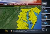
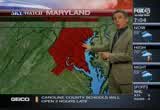
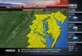
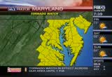
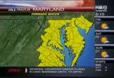
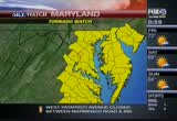
teams to tackle the ones that %-nnws for continuung overage f this story. we wiil talk to an officcallfrom the maryland emergency management agencyyabout how they prepared for tte storm. 7:00 hour. tropical storm nicole isú being blamed for at least two deathh in jamaica, including a ccild when floodwattr swept away a home. theestorm ripped through that country, knocking out powee and bringing down bridges. could increase because of flash floods and muddlides. now back here in maryland, there's a tornado atch inn, -ffect in he following counties until 1:00 this afternoon. annn arundel, baltimore county, baltimore city, calvert,ú caroline county, carroll, cecil, -oward, kent, mmnttomery, prrnce george's, queen ann's sooersst,
6:09 am
6:12 am
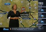
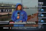
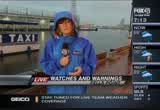
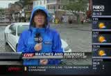
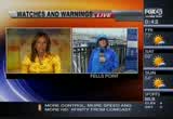
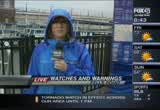
> meteorologist emily gracie is waking uppat fells ppint with all of the watchessand warnings, and it's been rainiig and pouring all morning long, emily. ú%> pouring, and we have been seeing bands of rrin starting late yesterday afternoon. it has ot stopped nd we it's 3 stopping. it's hit orrmiss but mmny areas are seeinggquite a bit of flooding and up to my ankles in definitely an issue across the area. we have much watches and warningg in pllce as the system3 moves through the arra. theee's the threet of severe weather as well. a tornado watch ii effect until this afteenoon for pretty much all counties around thh area. a flood watch and warring to the north and also a flash-flood warning for any of the counties righttalong the bay. means that these rains can come3 down n buckets and surprise yyu -s you are riding. it only takes a couple offinches
6:13 am
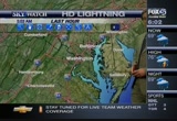
of water o do some damage and %-predicting, we will see nywhe -f rain in few locations here. the other thing we're dealing with ii thh wind advisory. a tropical ystem or the remnaats oo the tropiccl system moving up the coast. we havennt gotten into thattyett wind advisory. a lottof elements that are wwrking againnt here this morning, steee. i thiikkthe greatest seeinggthe flooding here in fells appoint. we will want to keep an eye on the radar because th the tornads an issue as well. ú% as typically is the case whee -ou have it moving to the beginning all of the heaviest activvty on theeeastside of that low.ú niccle whhch is a tropical --- %-and bringing up the lightningt strikess showing here aboot 50 lightning strikes which ddesn't sounddlike
6:14 am
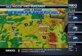
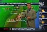
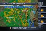
a lot ut we expect thhi toward the eastern seaboaaddand the eastern shore in general. as we get closer to where the area as seen the eaviest rain, ú%'s been to the south in virginia where we pick up an3 inch. ú% we looo at vvrginia, if we can ppck that up and et closer. you can see we haveeshowers tha3 are heavver to the east of the beltway, actually toward the edgemere and dundalk it looks like. indicating where the rain has southeast to the north and west and will continue toodo so. we willlwiden things out once that are seeing a decent amount of rain. -oo can see the west side of the beltway, we will get closer now. youucannsee as we get closer to the western side of the area, let's get closer toward ú%ederick and you can see new market street looking like we're going to see, or rather new market and some of thess streets yyu will see here. let's get a littlee3
6:15 am
-ddntification on the streets and you will see where you are.ú i-70 seeing heavy rain and 270 as well. we will continueeto see some of this activity moveetoward the north and the wess as 67 somm of thh shower activity areas that are seeing the hhaviest rain conninue to move in the northwesterly direction. while we ddn't have storr cells to talk about. we can still show you that the geneerl movement is going to take the strongest, let me see %-strongest storm.o bring the it's goinggto bring the rainfall totals where they ill be tte highest in the central part of the state getting up to 3-5 incces, and emily saying was ú%%-the state and oving north % 1:00 it tarts to ese a little bit..3 it looossbetter by point. -ome thh drier air creates more instability and that means afternoon. tonight for the eastern shore toward salisbury. we will be watching that area as
6:16 am
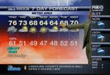
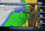
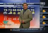
%-we have the stttiinary bouuday -raped over the area, steering the low pressure centtr which3 was nicole iiland. aa i saidd similar to kind of 72 and also not too long agos side of the chesapeake ay. west and we are goinn to see the jet3 stream the upper level support and more trengthhtoothe system. that is why we continue to see more moisture being brought in from the atlantic and up through the caribbean. -t ontinuus to brrng in agaii the tracking of the west side of tte chesapeake bay is what presents the problem for us, especially in placcs like fells point where we re seeing ú%rlier. 70 degrees is the emperature that won't change a whole lot. 76 the high, the winds will gus3 higher, up to 40 miles per hour and maybeeup 50 milee per hour especiallyyfor the eastern part and the central part of the state. 61 degrees for the the overnight low. and the 10-20-mile-an-hour wind but till breezy. we look at a whole lot better scenario as we get ttoard tomorrow. 77 or the high.
6:17 am
and partly cloudy skies, and windy then, 64 on sunday and the clouds move back in..3 partly cloudy on monday, and 64, and 67 for tuesday and wednesday. it's going to taae time for all of this weather to move through, tonight through as and through tomorrow. we will bring you updates throughout the day and throogh the night in we need to. i-radar is availlble at foobaltimore.com. track the rain down to your -p now we need a check of the roadways. laaren cooke has a check of the roadways. >> reporter: while theerain ú% leeding to quite a hecttc of flooding. iffyou're traveling in baltimore watch out for flooding at route 40 at ebenezer rooa. there's two feet of water on the road. make our way to soutt ballimore. weet patapsco avenue is going to
6:18 am
be shutdown at 895. as we take a live look, willlyou notice quite a bit of rain in the area.ú some cars are ssuck. megan gilliland is live in hee3 area and we will bring you a report cominn up in a few minutes. we do have trouble on the beltway while we're dealing with an accident at wilkens avenue. as we check in and take a live look, here, onll two lanes will be shutdown, but do expect dellys in the arra as we are making our way up the west sideú we're dealing with another accident both at outer loop of more trooble where we're dealing with a police involveddaccident at 83. if yyu're traveling on 83, we have a crash along the northbound lanes at belfast roaa. for those of yyu in howard county we are dealing with a crash that shutdown the lanes of interstate 77, it's an overturned tractor truck that was ccrrying milk. traffic is being diverted to the southbound lanes of route 29 or ú%that's a look at the traffic
6:19 am
edge. we will bring you more.3 we will bring you more.3 stay tuned for my dad is the supervisor of a train station and my mom's a teacher. my dad's an auto technician. my mom's a receptionist. i'm not sure i would have been able to afford college without the tuition freeze. while tuition in other states is rising out of reach... governor o'malley made the tough choice to freeze tuition. he made my dream of going to college into a reality. i'm the first in my family to go to college. my brother and i never would have been able to afford college. even though times were tough... governor o'malley kept his promise. there's never a doubt... there's never a doubt whose side he's on. martin o'malley... moving maryland forward.
6:21 am
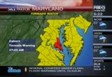
we want to romind you again, %-eefect in the foolowing counts until 1:00 this afternoon. anne arundel, balttmore county, baltimore city, carrline,3 kknt, montgomery, prince george's,,queen ann's, somerset, talbot, wacomico, and worcesser counties. now there's also a tornado warning that is in calvert and st. mmry's couuty and this is a change, because earlier this morning, there were watches. -s of right now they're tornado warnings and that is in efffct
6:22 am
for those warninns until 7:00 a.m. this morning. the tornado watches re in effect until 1:00 this afternoon. and blawz of th because of the e -lso have a school delay. caroline county schools are opening tww hours late because and heavy rrin, is offcourse, making a mess on roadwayy across our area. let's takeea look t what people morning. this is 695 at liberty road. yoo cannsee it's backed up in that area. be aware of that if you're headed in that direction. i-83 at warren road you see a long steady line of light rain there moving slowly in that are3 as well. 695 at 144 oving pretty fast in that area. but just again, use caution because the roads are slippery and wet and there's og in some areas..3 we will gee much more of that with lauren cooke in a little. coming up printing got more3 the two social networking old gibbs canning company.
6:23 am
6:24 am
pioneering new cyber security jobs and giving an old gm plant a jump start building electric motors. i'm barbara mikulski. i approve this message so you'll know i'm fighting for you. with three freshly baked bagel twists for only $3, like our delicious new tomato basil or sweet chocolate chip, so grab three for 3 today. [ ding! ]
6:25 am
uncertainty over the global economm pushed stocks lower on wednesday. the dow clooed 22 points lower at 8,335. and the sp 500 blo 500 lost 20. the president acknowledged receiving letterssevery day from americans struggling to make ends meet. >> we ot to make tough choices if we're going o solve some the the president says it's tough getting leeters from kids who don't wantttheir parents to lose hope. bp is shaking up its
6:26 am
bp is creating a new unit to operationaoperational risk aroue world. technology insiders say a partneeship is in the works between facebook and skype. by combining the two communication capability. facebook users would be able to log into skype and text, orr3 video chat with friends. neither company s commenting. p>> coming up remnants of tropical storm nicole rip into our region. meteorologist steve fertig is tracking the storm into your neighborhood commng up fter he break. significant flooding here in the city.ú take a look at this and still some drivers trying to make their way through. iim megan gilliland. we're going to show you how dip this water is coming up. i'm meteorologist emily gracie liie in fells point where
6:28 am
6:29 am
welcome back to fox 45 morning news. 6::9 is the time. i'm patrice harris. remnants of tropical storm nicole are barreling down in our region. we haae eam kanc coverage of ey angle of that storm system. our weather team is keeping you safe on the fiell. -milemily gracie is at fells pot covering storm conditions and the ffood watcces. meteorologist steve fertig is
6:30 am
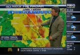
tracking the storm right down to your neighborhood with powerful skk watch hd radar. all of that rain is making a mesa cross the roads in our area.ú lauren cooke with will bring you the biggest trouble spots in the morning commute coming up in the traffic edge report.3 -p because of the weather we caroline county schools are opening two hours lateebeccuse %-meteorologist steve fertig because he has tornado warnings to tell you about. >> reporter: that's the focuu right now patrice is a tornadd warning in talbot county until ú%000a.m. and st. mary's county that will be moving to the north perhaps. we will be watching it closeey. those areaa you will watch it iú the lowest interior room of your home until you hear about the lesseniig of those tornadoes. the conditions arr ipeeas the
6:31 am
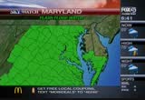
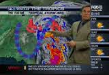
coastal low continues to move up in our irection. radarrand we will get closer. %-to the south.ut the storm dowú you can see down toward the area, we're going to get clougheclosertoward the region r points southhof that. llt's take a look at here the ssormm aae at chesapeaae beach. we ggt closer still and we will terms of the storm that are strong in that region where we have the tornado warnings. this area we see in the red bringing down the heavy downpours. we are going to identify the areas with the industrial level mapping. further points weere gging to -ave to ee out of our our view, chesapeake beecc roaadis definitely in the line of these storms. what you cannexpect to see.ú is these storms moving toward the north and east and again, they''e going tt continue to move in our direccion rom south
6:32 am
%-toward, it looks like, well nt showing, frederick until 7:24. 3-5 inches offrain ith flooding concerns. we will get you updated. right now let's send it ovee to lauren cooke who has the traffic edge.3 >> reporter: thank you, the heavv rains are certainly having an effect on the commuue. we are dealing witt a ton of accidents ann flooding. %-aruudel county, routeanne 450:shutdown, and you will want to stick with bellwood branch as an alternate. we are dealing with a significant amount of flooding at whiiemarsh. there's two feet of water on the road, but in south baltimore, things are really looking bad checking ii and taking a live look at west patapsco avenue where they are shuudown at marmaco road. a star is stuck. with you're in south baltimore i this road as that car is.
6:33 am
chance of getting stuck. don't travel in the area. avoid it at all costs. we do have several accidents. fortunately one has cleared on3 the west side of theebeltway at3 %-as you make your way toward te crash. as you take a live will be at libeety road. it's going to be jam packed. allow yourself tr extra time asu head out. along tte outer loop as you approach the jfx. this does involve a police car. do expect delays ii that area as well. that's a look at the traffic edge.3 paarice, back to you. when the rain oes come down this hard, all eyes turnnto patapsco avenne in ssuth baltimore..3 a section oo that road constantly floods as we saw %--rapped inside.k and drivers %-the latest on how commuters ae making through there thii morning. good morning e ming an.
6:34 am
>> reporter: good morning, patrice. things are etting serious, this is patapsco avenue east and westbound lanes are shutdown, but for some reasonn cars are now making their way through, them.3 you an see a car right here tried to make their waa. it stalled out, there's a man, a resident nearby that is trying to warm cars, yelling and streaming toothem to stop, don't come through here, don't come through here. you can see ow deep it is. for some reason cars are coming through. we take a ookkat where the news van is, the fire company let us through this farrso we can show you how dangerous this ii. now t appears that the general traffic is also making its way down here as ell. if you are headdng down to patapsco avenue, you need tt be careful. understand the significant amounts of floodiig that are ahead of you rrght now. you can sse some cars are actually heedinn some warning, hopefully seeing us as we are telling thhm don'ttcome through. a lot of them we are seen them try to push their way through, and then they tall out.
6:35 am
the fire department has to come through. if you go through one of the blocked barriers you will get a citation. you're not supposed to drive in this area. there's significant amounts of flooding all over the city. thissis not the place to be driving through and thh rain is still faaling right now. %-whht is happening on patapsco avenue in a little bbt. reporting liveein south bbltimore, i'm megan gilliland. fox 45 morning news. et's take a look aa at anne smith is near the hore of the chesapeaae. good morning, joel. what are you seeing out there. >> repooter:: patrice, it's coming ddww. the wind has kicked up within a few minutes. the shore hasn't been affected too much. level since we have been out here since 4:45. take a look at thh ffag over there. wwtyou can see how the wind is higherrthan others.getting backkup here, now this is lake here in souttern anne arundel
6:36 am
county right nearrthe come the e bay. more like a creek or a streaa as the water is starting to rush right through. if you can follow it down where it goes, it starrs formingga bit of a lake on tte way here. therr's certainly flooding issues will be happening here very sortly. s-- shortty. ú%ght now waitinggit out and nobody walking around yet aad staying inside. these folks are sed to seeing flooding scenerios and another one is oming their way. right now not too bad. joel d smmth, fox 45 mooning3 news? staa tuneddto fox 45 morning this story. the maryland emergency management about how they are that is coming up in the 7:00 hour. we want to remind you again, there's a tornado watch in effect in the follooing counties until 1:00 thhs afternoon. anne arundel, baltimore county, baltimore city, caroline, carroll, cecii, charles,
6:37 am
dorchester, harford, howard, kent, montgooery, princc george's, queen ann's somerset, counties and now there's a tornado warning in calvert and st. mary's county and that is the change, because before they were waaches. warnings. well, coming up taae care of your heart. the quessions to aak beforee3 going under the knife that could savee our life. the severe wwather is really taking its toll on your commuue this morning. here is a ive look aa liberty road where we're dealing with a ton of congestion. i will have more on accidents and flooding coming uppin my traffic edge report. >> reporter: i'' meteorologist emily graaie, there's flooding in fells point this
6:40 am
we are starting on of the morning with a lot of rain and wet weather. -hat is the experience that many marylanders re having right now as the remnants of nicole make its way through the area. emilyygracie has more on the system. %-let p a little where you are, that is what i was going to say, patrice. it's let up a little. we have seen the storms ome and go. that is the band of showers and south. showers coming rom the it's nowhere near over.ú it rained all night and it will continue to rain all day today as the system pushes through. weehave watches and warnings to talk about. the most crucial is the tornadoú throughout the whole area. the system is moving up from the south. you do the math, you have a county to tte south and it's moving from the south. certainly a possibility that we could get into that more severe weather here in the next hour o3 so as it continues to push up from the sooth. we are also dealing with flooding as a concern flood
6:41 am
watches and warniigs acroos the area. flash-flood watches nddwarning3 as well. the flashhflood warnings mean ttat the water couud rise unexpectedly. a good idea not to rise through the weather service wants to telllpeople, tuun around and don drown. you don't know how deep the water could be s sober safe than sorry. tte tornado warning the most crucial thhng to talk about thii morning. absolutely. we are going to talk about additiinal rain falls that aree3 going to add to the chance of ú%ooding. we are in or a long day at the ú%ather center. the lightning trikes showing you 60 to 70 lightning strikes through the chesapeake area, where the storms are stronger. the storms have been the strongest and where the ú%wnpours wheee we hhve seen themmthe greatest and you can see toward 665 where we are
6:42 am
seeing the heaviest showers toward the east of that arra. you see areas like annapolis which is seeing heavier rain there now there and hat is moving through the the north and as emily said urther areas south that is seeiig the tornado warnings could move further north. let's get closer still and head towwrd the beltway if you'reú heading out this morning. if you don't have, it's better ú%at you don't..3 as we zoom in closer, let's see if we can get clossr to toward %-we will try to bring that up r you. onnthe beltway area it's lightening p for the time being. that is where mily toward thh fells appoint but the area. we are seeing eavier rain toward thh east and we willlhead over there. here is what we will find up to the north and east up toward it looks like aberdeen. seeing heavy rain here, the loo pressure center traaking north it going to continue to bring heaviest rain to the 695 and also i-95 beltway..3 %-storms to the north and west.
6:43 am
if we look at where some offthii heavy rain will be moving if it's moving north and west, ú%pect aaound seeing the strongest storms or showerssthat are heavy toward 7:00..3ú thaa is not the torm as much as ú%e heavier rain is falling right now. let's take he ook at the raii from the rain from the south. it's moving from the southerly direction where niiole was. now the coastal low ann theú trackkng of storm is goinggtt be -mportant as with where we get the heaviest rain. %-side of the chesapeake bay.est and through afternoon and evening as well. how much rain will we ick p from here.3 emily is indicating 3-5 inches. the eaviest rain will be toward the centrallpart of the state. flooding concern through the afternoon and evening aa well. we will be watching as you can see thh yellow arra moving north. that is where the heaviesttrain in. thaa creates mooe instability and thunderstorms will pop up in the heaviest rain showing up in salisbury later in theelate
6:44 am
night period. as far as the rest offthe forecastt we have the lights seú up tte stationary boundary over3 us. that is goinggto bring in some of ttat low pressure centtr that is the coostal low that was nicole.ú we have the jet stream back to the west and that is also adding some extra support and that is %-bringing in more gulf moisturú meanwhile the track of the north is going toobring the west side ú%e chesapeake bay, that is why3 downtown we are lookkng at heavy downpours and flooding concerns. bbltimore. up in hhgerstown 61 degrees the temperature won't change much. the windsswill become a factor later this afternoon as they gust to 41 miles perrhour. a 10-20-mile-an-hour wind and still showers nd thunderstorms fob in thpossible in the eveein. we starttto get a reprieve, and theewindssup to 20 to 25 miles looking sunnyybut cooler. 66 and 78 for tuesday and
6:45 am
wednesday. we have a long way to go, guys patrice,,it has quute a long day you can trackkthe storm all day long right down to your neighborhood, fox 45 iradar is available at fox baltimore.com.ú you can look at interactive tools to track tte rain right down to your street. just go and now let's get a check of our belt ways, lauren cooke is here with the traffic edge. busy morniig ffr you, lauren. %-the heavy rains are leading ta hectic commute. the route 450 is shutdown and you want to stick with bell3 branch as an alternate. in the whitemarsh area we're dealing with flooding at ebenezer road about two feet of water are on the road. it will persist as you make your way to south baltimore. checking and taking a look atú west patapsco avenue. that car is going to be stuck. you do not want to ride in this
6:46 am
area.ú ii will be shuttoww, so you do want to avoid it at all cost. if you're travellng on the beltwayy expect delays due to a crash in the outer loop. will you notice how congestedd3 the outer and inner loop illú if you're traveling on 83, ww are dealing with a crash there ú%belfast road.nddlanns at another crash on the top side of the beltway right on the ouuer loop of 83. it involvee the police car. for those of you traveling on the nnrtheast corridor of 95, weere dealing with a truck fire along the mountain road. it has shutdown one of the southbounn lanes and then we do ú%ere a crash has shutdown the eastbound lanes of eastbound 70, between the columbia pike and the patapsco river ridge. traffic has been diverted. you can stick with the -lternate. patrice, back to you. thank you, lauren. still ahead, pick the best
6:47 am
heart surgeon for you. under thh knife.ask before going and next video taping police oo the job. i thought it was crazy feeding in the fall. i always feed in the fall. but, it's the best time. feed your lawn in the fall. the fall feeding makes all the difference in the world. what the fall feeding does is build the roots.. that's when the roots sorta want nutrition. i give my lawn scotts winterguard. it's like a root building machine. it builds your lawn from the roots up. next year you get this! the stronger the roots, the stronger the lawn. all year long. the best time to feed is when it will do the most good. there's no substitute for the fall feeding, trust me. it is the best thing you can do for your lawn. i use scotts winterguard.
6:48 am
[ monkey cheeps ] [ male announcer ] a bath becomes even more pleasurable when you know that your water is being heated in an environmentally- conscious way while saving you hundreds of dollars on your water-heating energy bill. the geospring water heater from ge with advanced hybrid technology. heating the water in your home any other way is just going to seem primitive. [ monkey cheeps ] ♪ maryland residents can save up to $780 while funds last. and i'm investigating what makes aruba so happy. oh my word, that's fantastic. ♪ row your boat gently down the stream... ♪ i'll tell you what; it's not aloe vera the main export. it's happiness.
6:49 am
i haven't even got bait on the end of mine. i don't care; it's just nice sitting here. you're getting it. you're getting it. new this morning, there's a tornado watch in effecttin the ffllowing counties until 1:00 this afternoon. anne arundel, baltimore county, baltimore city, cclvert, caroline, carroll, cecil, charles, dorchester, howwrd, kent, montgomery, prince george's, quuen ann's county, somerset, st. maryys tallet ba , wacomico and cccil county. nne arundel county police are nvestigating a double stabbing in annapolis. it happened at 11:15 last night
6:50 am
at 4th street. one man wws shot and taken to shock trauua he other went to a local hospital. ' bus plunges off to the 45 feet onnto interstate 270 in montgomery county. the driver of the bussof hanovee, pennsylvania dried at the scene. 12 others were hurt includinn a driver on 270 whose car was hit by a light poll knocked over in th--light pole knocked over in e accident. a harford county judge ruled in favor of a man who recorded his traffic stop and posted it on the innernet. police arrested him saying he violated maryland's wiretapping law that it was illegal for him to record without the officer's consent. the judge rulee the officer had no expectation of privacy and therefore it wasn't illegal. talk show host and former police commissioner ed norris joinssus for this week's fox uudercover. >> good morning.
6:51 am
>> so baltimore city police areú saying that they disagree with ú%at the judge said and they stiil plan to arrest people if theyyre recorddng police officers. who is right and who is wrong in thissincident? >> i believe he judge is right. in the public domain, you're on expectation of privacy walking downnthe street, that's why you3 have cammras. the fact that it audio, it's being a knit picky. i now at maryland you caa't reccrd audio unless the person's consent. have to get up to speed with3 technology. if you are a public offiiial, i think you're doing a job on the stage and you have to be subject to it. p> that is one of the points that the agl you, the police say that anything you say or do can be held against you. we can use that, why shouldn't the same apply to police. why shouldn't what the police officers say be able to say and
6:52 am
do. >> with cameras o!! in the car. you should know when a phone is open, and audio is being recorded so consent is being implied. it's a silly argument. compromise their investigation. in what way? >> you got me. i have no idea what thee're talking about. p> it seems like they want to be able to maybe something that is3 not proper nd you don't want the public to see how you do whattyou do and that is what the concern is. >> i think that the public neees is not pretty. it can be brutal and that is where the education issue and >> baltimore city police say people if they are recording them. is that goinggto stick?ú if i go out there and i record something and they take me to jail, do they have a case againss me since this is a gray area, even though the howard county ruled one thing.
6:53 am
it's not just common-law. >> reporter: i think they're going to challenge this. they will see this in the appeals court. they're going to challenge it and we will see how it turns out. i think the judge is right. if someone recorded a person assaulting a police officer, would you prosecute that person, you will use it? >> absol blue diamond almonds! more bold flavor!
6:54 am
6:55 am
6:56 am
stroke right after she had heart bypass surrery. she never expected to hhve trouble walking 5 months later. now becaase of the stroke. the cardiac part is fine. they tell me, but it's not -- because can't drive, i can't go to work.ú >> reporter: a heart bypass operation is major surgery. and there can be big differrnce inside the outcome. a consumer report analysis of 221 surgical groups found thaa complication rates range from a high of 30% to a low of 6%. >> suffering a stroke is one of several potential complications from bypass surgery. there's allo a rick of kidney failure, infection and death. sometimes the pattint needs a repeat operation. >> eporter: consumer reports says before you agree to bypass surgery, it'' important to do ask if he surgical group submits their results to the
6:57 am
society of thror a thoracic surf national database. >> 90% of the the groups submit the results to the societt. number of important measures. that data you want to know. >> reporter: bbpass surgery data to ask about includeú patient survival rates, and the ratt of cooplicattons. >> it'' really surprising hat %-more of the purccase of a car than the cardiac surge ron. >> reporter: joyce wishes she had asked more questions before her bypass surgery. thii is james annrews. coming right up after the break. how much rain is the storm goiig to dump on your neighborhood? meteorologist sseve fertig is in our sky watch weather center. he is tracking the ssorr's every movee we will bring you updated rain totals. takeea look at this. we're dealing with significant flloding here on patapsco avenue.
7:00 am
america saves on dunkin', america runs on dunkin', with three freshly baked bagel twists for only $3, like our delicious new tomato basil or sweet chocolate chip, so grab three for 3 today. [ ding! ] waking up to heavy rain. the remnants of tropical storm nicole pounds our area. you got to be prepared foo something like ttis. how much rain you can expect in your neighborhood and what you need to know to get throuuh yoor morning commute. every day thing.lthy liiing an
7:01 am
expert tips on staying innshape. ú% septemmer 30th. it's hursday, i'm patrice harris. theecity's emergency operationú centers are now open. %-flooding out there.sng if you need assistance for flooding you can give them a call at 311. remnants of tropical storm ú%cole are barreling down on our region. we have team coverage of every angle of this storm system. ourrteam is keeping you safe in the field and in our sky watch weather center.3 meteorollgist eeily gracce is at fells point live and she is covering the storm conditions ask all of flood watches we're
7:02 am
talking about.ú meteorologist steve fertig is tracking the storm right down to your neighborhood with our fourful hd radar. makes a mess on the roadways. we are taking a live look at the roadways. thattis on 7 at route 100. you the the biggest trouble ú%ots in the morning commute. that is coming up later in the traffic edge report. our entire news crew is out in meganngilliland is live in south %-joel d smit!!!! smith is repon anne arundel county. offthe weather we have a school delay to tell you about this morning. caroliie county schools ooening two hours late due to the og and now we want to get right %-the sky watcc weather centtr r a closer llok at the storm. all of this activity is coming up the ccesapeake bay ú%ea. the tornndo warning have expired
7:03 am
in talbot county and st. mary's county but that is where the activity hassbeen the strongest as ww get closer intt the area south of bath more, you are seeing some of the heaviest rain ú%dicaaed from annapolis down moving up toward the north. you will continue to see that moving in the northerly direction and ssme of the stronnest and heavvest rain is going to be moving toward the west of the area. seeing rain ii severna park as well as pasadena. we will continue to watch the moving south north in geeeral. additional rainfall amounts coming your way. up. a lot oo moissure coming up from the south tropical storm niiole. it's a coastal lowwthat is even though it's not a tropical system we have a lot to be concerned about. take a look at the watches and warnings. a flood watch in place, a flash
7:04 am
ú%ood watch through the morning hours and the flash flood watch3 continues through the afternoon of the a wind advisory that could get up to 44 to 50 miles per hour adding o the mix. we havv a long way to go. it'ssgoing toobe a rainy day all morning long. we will bbing you up-to-date all day. as far as what is happening on the roadways, lluren cooke is here with the traffic edge.ú i think we have a little bit of a clue, auren. >> reporter: the rain has made for a hectic commute this morning. we are dealing with a ton of accidents ask a ton of flooding as well. as we aae traaeliig in estt3 baltimore patapscooavenue will be shutdown at 895. as we take a look in thh area you will see how bad the flooding issin the area. the stalled car has cleared. you wwnt to avoid the area. -e are dealing with mooe flooding in anne arundel county. we have shutdown at bell branch road as an alternate and mmre of baltimore county right in at
7:05 am
whitemarss at route 40 at expect deeay delays traveling southbound due to a truck fire at mounttin road. more problems at the west side due to a crash on the southbound lanes just as you approach the harbor tunnel thruway.úif you a. we are dealing with a crash on tte west side checking in and taking a live look at iberty road. goinggto be. we do have 875 thaa you want to watch out for. that's a look at the traffic edge. bpatrice, let's send it back to you. anytime it rains like this, -rrffic snarls on patapsco avenue in south baltimore..3 a section of the road sometimes floods inches deep nd cars often get stuck.ú -egan gilliland is live there with a look at how things are shapinn up this morning and it'ú
7:06 am
amazing that cars still try to drive through that. look at, you megan. >> reporter: it say it's word for it. is not even the3 thissis noo eeen the deepeet wart. if we go far. %-the middle of this river. in this patapsco avenue in the eastbound and norttbound lanes. the last ime you aw me. that was not sttpping cars from driving through here. minutes ago a car was stalled out. they were able to push her up to safety.ú the probbem we're hearing up the road barriers arr blocking up the road. when they got to us it's decision time to see if they could make it hrough. we saw cars barrel their way through waves. we have seenn hree cars get ssalledd firecrews are at the end of the road and ready to come pull these people out. if you do move one of the barriers at the end of this road, you will get a citation.
7:07 am
waiting for you.are there this is not something you want to try to make it through and pouring on us right now. this water is only going to get deeper as the morning conttnues. we will be here for a couple of showers more and let you know how things aae coming in. llve in south more, megan little fox 45 morning news. over 1,000 homes are without %-are in a run dea anne arundel. what are you seeing joel. >> reporter: in this area everybody still has heir power. you see the lights on. as you look out here, this is change with tte actual tied a coming in. it'' not threatening tte shore here getting into the street..3 thhs is lake ddive we are going to show you right now. ittforms a little bit of a lake as it comes out of the way. this is one of the tamer timee we have had today so far.
7:08 am
reaaly whipping winds earlier. right now -- >> and that's the problem with the storms out there this tropical storr nicole is also being blamed for at least two3ú deaths in jamaica including aa3 child when floodwaters swept that storm ripped through the country knocking out power and even bbinging doon some bridges. officials say the death toll there could increase because of flash floods and mudslidds. back here in maryland, we do want to remind you again, that thhee's a tornado watch in until 1:00 this afternoon. anne arundel, balliiore county, baltimore ciiy, calvert, caroline, carroll, cecil, charles, dorchestee, howard, kent couuty, montgomery county,ú prince ggorge's, queen ann's somerset, and worcester county.
7:09 am
7:11 am
>>the remnants of tropical storm nicole are still barreling down in parts of maryland..3 residents throughout the region3 are waking up to a lot of raan. -nd emily gracie issat fells appoint with a lot of watches %-there was a little break a whe ago and it doesn't seem that way anymore.3 it was a light boom. the rain is coming down heavy at this is one of those instances where it's coming down heavy. we are seeinn street floodinn.ú we saw megan up tooher kneessin water earlier.
7:12 am
definitely a threat all over the threat.nd severe weather a we have a tornado watchhin effect pretty much for all of the ccuuties across the area and as theebands f moisturr come ttrough. we are goong to see a severe weather and the tornado threat. we did have the tornado warning earlier for calvert county and something that coold top out for -any other counties as the day goes on.3 alsoowatching for flash-flooding. it means that as the downpours comm doww, flooding can occur as a matter of seconds so the water level can rise and become3 dangerous as a few inches of water can floa flood a car. it's a situatioo that you doo't want to drive into, because you don't know how deep the water is going to bb. dealing with the wind as a threat as you go latee into thiú afternoon and the tropiccl moisture and system comms as the remnants of nicole was briefly a tropical storm. - don't think that matters
7:13 am
because we're still feeling thh ú%reat as far as severe flooding ú%d wind as the day goes on, steve. not even a tropical gretion butn but tte threat remains. we are moving on the west side of the chesapeake bay. ii poses the problems on the west side of the problem. showing s much as 50 to 60 sound a whole lot.ú as we take a look at had a we have on our sky watch d radar. first of alllindicating a severe thunderstorm risk for the -entral and eastern shore area that is wwy the tornado watch there oints points wes points n3 let's get a closer look and show you what the 695 beltway is closer. just toward the south of glen burnie where we're seeing the area of red and ooange. ú%'re eeinn heavy downpours. snoazzshowers ar!!those showerre
7:14 am
moving to the north and the west. as you see that path, we are goong to be able to bring up to yyu, and be able to show that we are bringing to the southeast and north. that. we are seeing areas where we are seeing heavy downpours where we move on out of here a little bit. take a look at what we have as far as other areas up to the i wwnted to how you that as3 well. we will go this way, it looks like w'reegoing to bring you tte chance of some showers that will be again strengthening. letts see how much rain we can pick up so far. an inand 3 quarters and as much as as half an inch in salisbury. the half innh is in the south. you may have seen 3 plus inches in virginii. it's goong to beemooing from the north. indicating 3-5 inches oo rain and that is what we're thinking. again the path will be on the west side of the chesapeake bay for the low pressure center to move up. the heaviest rain mooing up to the north. and lining up to the points south. and then we see this spot moving
7:15 am
in. howeverrthat creates more instability and the chance of thunderstorms popping up.3 note the heavyyrain in the late night period so it's not quite over as we get into the latter still strong winds as ell. meanwhile we haae the stationary boundary along the astern seaboard. ii's allowed for the loo pressure center which was nicole to the move to theenorth and east. that low pressure center mmving along the west chesapeakeebay. it's bringing the greatest storm strength on thh eastside. that ii why we're seeing the eastern shore as well. 71 degrees right now. the tempeeature in baltimore is not going to change a whole lot. and ww're ot thinking about -he heavy downpours causing flooding concerns. the winds that are gusting up to 20 to 40 miles pee hour. 61 the overnight loo. showers decreese in strength some. tomorrow a much better scenario.
7:16 am
73 degrees for the high. ww're goong o bb talking about the temperatures that will be coolinggdown as ww get toward the weekend. we will see, again showing you expect the 60s for the weekend. that is the biggest concern so we keep focused on the poosibblity of severe weather with heavy downpours ith severe what, patrice, let's send it back to you. storm right down o the specific neighborhood. i raaaa issavailable at foxbaltimore.com. very easy to use. the ente interactive tools and u can track the rains down to your street. all you have to do is gg to foxbbltimore.com/radar. busy morning out there. lauren cooke has the traffic edge. good morning. good morning, patrice. it's going to be a very hectic commute. heavy rain is certainly taking its toll. ú% do want to watth out for %-look in the arra you will note
7:17 am
what we're talking about heavy,3 -eavy rain. megan gilliland will bring you an update. route 455 willlbe hutdown at bellwood drive. and more ii baltimore county right at whiteearsh at the intersection of route 40 at ú%enezer road. we do haae a truck fire that is affecting the roadways. as we make our way to the with another crash along the southbound as you approach the harbor tunnel thruway. eepect slow speeds on the beltway, we're looking at road..3 as you ake a livv look, you will notice how congested it is. that is due to the weatter, the crash at 795.3 we do have trouble in howwrdd3 %-shutdown the eastbound lanes f interstate 70 between colummia pike and the patapsco river bridge.útraffic is being diverto
7:18 am
%-you can stick with route 40 as an alternate. that's a look at theetraffic edge report. stay tuned for continuing team joining us we will have an ooficial of mima and he will provide us with an update of prepare for the storm. you are watching ffxx45 morning news,,all local all morninn. get any phone free only at verizon
7:19 am
7:20 am
7:21 am
earnedd governor o'malley will be in cecil countyyto help usher n the new era of clots? maryland. slots -- slots in maryland. the 1500 slot machines on the premises should bring in millions of dollars a year? state revenue. a tropical storm that started in the caribbean ii now %-maryland.ot of rain on per hour winds. governor o'malley activaaed the state's emergencc oppration %-ed mcdonough with the maryland management agency meets with us to tell us how the state is prepariig. >> good morning. >> this isn't the worst we have seen around here. it's something we should be aware and plan and be cautious for. what are your biggest concerns. >> roaadays and trees coming down and power outages. those are the biggest oncerns we're facing.
7:22 am
>> we when we talk about the emergency operation centtr being activated what do you monitor. >> right now we have groups like the red cross that willlbe unner our facility. they respond to local concerns where local officials do not have newer resources to handlee3 what is going on. >> we keep mentioning the flooding because thaa is one of3 biggest problems ouu there. if someone becomms trap and it becomes a dire situation that is whereeyou will kick in. >> for those of situations the fire respondents will be able to handle it. what we can do and help move around swift water rescue teams. >> power outages become an issu3 as the day goes on. whaa role will you play if that %-we have throughout the day, because we have power commanies involved. we will have utilities vostledz. involves. we can monitoo and track a number of outtges and help thh
7:23 am
number of managers deal with the police and highway crews if there's highway or traffic3 ootages and things like that. how to use precautionve folks themselves. what do you advice. saying, if you see standing water, don't driveethrough it. donnt go around barriers that3 police or highway folks are set upp if you lose power, be carefuu. if you have a general 8 or!! gee sure that you vent it properly3 >> when tropical storm isabel came through this area in 2003, that left a problems.3 fortunately his didn't come quite in as a tropical storm. >> this could present diffeeent issues. along the coastal area of the bay and the tributariess this could present more streams. that coull preseet a challenge because we have plenty of those areas.ú >> thank you for coming.
7:24 am
7:26 am
7:27 am
patrice, if signed into law this bill would private $3.2 billion over the next year to monitor and treat injuries stemming from exposure to toxic dust at ground zero. it would provide compensation for job and economic lossee. they were the first to answer the call for helpponn3 september 11, 2001. ú% it's like a horror movie. everywhere you went to, there was dust.3 it was in the aii, it was on the grouun. it was on everything you touchee. it was horrible. -> reporter: now many ofú those first responderr are is heard. busloads of them descended n the capital this weekend urgiig congress to pass a bill that could compensate those exposed to toxinn fter the attacks and provide them with free ú%althharee the bill is passed.ú [ cheering ] >> the bill was approved in the house 268 to 166. >> we remember whht you did i at
7:28 am
theetime and it wasn't only your sacrifice, it's the sacrifice of your family, of your health and the impact that that has on your fammlyy >> reporter: most republicans say the $7.4 billion bill costs too much but 17 voted to pass it including ew york reeubllcan peter cane. >> what we did was what you had to do. what you did is what you volunteered to do and chose to do. you put your lives on the lineú for us. the very least we could do is what we did. >> reporter: the ssnateemust now pass iis version of the bill before it goes to president obama's desk to be signed into law. the reporting liveefrrm patrice.on i'm nicole ccllins. nicole what are tte chances ttat of happennng that it will pass in the ssnate. >> reporter: well, it's unclear right now. republiccns certainly have the votes for a filibuster or to block the bbll from moving forward. senate democrats haven't seemed to interested in bringing this
7:29 am
bill tt the floor. we will have to wait and see when everyone gets back on move aafer this ii the coming congress. coming up the rain is still pounning across the our regionn %-center.our storms evvry move we tell you hoo much rain is coming up and when it will stop after the break. already we have seen several cars get stuck here on patapsco3 avenue where water is flooding over here. i'm megan get any phone free only at verizon
7:31 am
7:32 am
morning news. eafn 32:00 is th7:32 is the tim. the emergency's operation center is now open..3 that is because with ss much rain, you know there's flooding out there. if you need aasistance for flooding, you can give ttem a call at 11. p remnants of tropical storm nicole are barreling down in our region. we have weather team coverage. our. covering the late test storm conditions and the flood watches ú%teorologist steve fertig is track the stormmdown to yyur neighboohood. heavy rain makkng a mess on the we want to take a look at some of the roadways. that seems fob movinn along just fine but that is not the case throughout the region. lauren cooke is going to bring you the biggest trouble spots that you face n hh morning commute. that is in the traffic edge report.
7:33 am
our entire news crew s out in the elements. megan gilliland is live n south balttmore in a pretty ffooded aaea. county. they are getting hit retty well. right now we are checking in with steve fertig. there's been a little confusion, because there's two low ppessure centers that are affecting us and low presssre thaa is what we're getting theú brunn of the coastalllow..3 it will continue to be a combination of both systems. yyu see tropical or rather a tar naitornado watcc in place. sere wwveather a concern today. ww will check out the lightning data. you will see that we have anddeast as far as 30 lightning strikes. take a look at our sky hd rai rr when we gettcloser hereeis what we will find. we have eavy downpours in the
7:34 am
ú%stside which is closer still. we putta couple of locate locad u.s. 40. we have, again the heaaiest rain to the astside of the city. most of the activity is going to stream up from the south as ww continue to see theesystem from both the coaatal low and also the remnants of nicole which will be moving to the north later on. that is why the rain will continue through today and tonight as much as 3 inches of rain could be expected. weewill get you caught up on the rest of the details in just a minute. %-lauren cooke who here with the traffic edge. lauren. >> reeorter: thank you, -teve. theeheavy rains have led to a hectic commute this morning. %-aacidents and flooding across the region..3ú if you're traveling on the beltway, expect newwdelays due to a crash. from the beltway.sh has cleared
7:35 am
you will notice quite a bit of congestion. this is going to be 97 attroute 100 looking prettyyrainy in this viciiity as well. you want to watch out for reeuced visibilitt and look at 12 miles per hour allng the outer loop in that area. it will be a very slow ride. problems in howard county where we're dealing with a crrsh where a milk truck overturned shutting down interstate 70 at columbia pike at the patapsco iver bridgg. traffic is being diverted to th3 southbound lanes f route 29. it's shutdown 1 souttbound lane at mountain road. we're ddaliig with quite a bit offflooding in baltimore county. two feet of water on the road on -oute 40 aatebenezer road and problems as we make our way to middle iier. eastern boulevard is shutdown due to flooding. you want to stick as an alternate. ppoblems persist as we make our way to dundalk. you o want to stick with north point boulevard as an alternate. megan gilllland has been live in
7:36 am
south baltimore all morning. herr is a live look at how ad it's going to be shutdown. many cars have been stuck in this vicinity. you do want to avoid it at all cost. ú%at ii aalook at the traffic edgee patrice, let's send it back to you. ú%> you just heard lauuen mention it, but anytime it rains as heaay as it s right now. traffic does central on patapsco avenue in southhbaltimore. aasection of thattroad floodsú inches deep and cars try o make it through and they get stuck.3 megan gilllland is live there right now with a look at how things are shaping up this morning and aaain they're getting stuck. good morning, to yyu you an see out your window that it is raining out. whht you cannot see this, as yyu areeheaded down patapsco road and a lot of other roads, water cootinues to get deeper and deeper. it caa get ddwn our waste andue,
7:37 am
getting closer up to there. you an see cars coming through. this ii what we haae been dealing with. this road on patapsco avenue s closed east and westbound but people are now moving the -arriers, moving thh cones overú %-this man right here we just spoke with a minute ago. he said he wasn't going to try this. thinking he is going to do this. if you re one of the people that goes through he barriers, like his line of cars behind is well over $100 and you riik ú%tting your car stalled in thi3 water here. we have seen three people get %-apparently, patrice thhs is. something that is again. there's barriers out there, but as you can see, when one car starts pushing their way througg then a whole line of cars is. we will see what happens. we will watch these cars here. it looks liie the first one is having troublee3 it looks llke the first one is cominn out the front. if you see barriers do not move
7:38 am
them. they are there for a reason..3ú you could beelike thhs guy. we are live in south baltimore, -'m meggn gilliland. foxx45 morning news. that's ithat's just amazing. let's take a look at the conditions at the chesapeeke bay. getting stuck. nobody moving in your area, that's a good thing. >> reporter: in general, these people know how it goes. sometimes it gets 2-3 feet where i'm standing. we're at lake drive. we are talking abouttthis much water. they say suallyythe water comes the other way from the bay -- as can you see -- just rushing into it. >> all right, joel is experienciig problems. the raii is coming down interfering with our signal there. right here we want to remind you -gain. steve mentioned it earlier, but3 there's a tornado wwtch in
7:39 am
effect in the following counties until 1:00 this afternoon. anne arundel county, baltimore counny, baltimore city, calvertt charles, dorchester, harford,,3 george's, talbot, acomico aad worcester county. there were tornado warniigs for calvert aad st. mary's county, those have expired and they're back to watches in effect until 1:00 this afternoon. coming up exercising and an expert is here to taak about the keys to hhalthy living..3 expect coogestion on the west side of the beltway here at frederick road and there are a ton of accidents aad flooding on many of our main lines. i will let yyu know ow the ds! more bold flavor! more variety! more value! more of what you want...
7:40 am
7:42 am
we are starting off theú morning with a lot of rain and wet weather. that is the experience that many marylanders are having right now as the remnants of tropical storm nicole make their way -hroogh our area. emily grrcie is live at fells3 she has been out there soaking wet at thii point but you have more on what is happening. here all morning and the raint has not let up at all. if anything, it's coming down3 heavierment e are looking down at the water. we had a heavy downpour and the water flowing steadily. the thing that concerns me is low ttde at 7:42. high tide coming shortly in the afternoon. this is what it's lookinn like at low tide. as the day goes on and we
7:43 am
continuueto get the heaay rain,ú definitely going to be threat of some flooding at fells point when the tied comes up shortly in the afternoon. and anything is going to get heavier. we are dealing with a thheat of severe weather or a severeú tornado watch across the aaea until 1:00 p.m. this afternoon. we have had some warnings pop up and go away and certainly that the threat as the afternoon goes on as well. also dealing with the flooding. we have seen street flooding in fells pointtand flood watchhs and warnings posted for aalú across the area. flash-flood warninn in effect for especially those areas rrght along the water. now that flash-flood warning meaning that the water can rise quickly with the downpours that do come through theearea, anywhere from 2-5 inches expected swrevmen have had an ie the other thing we're dealing3 with this morring ii wind advisories. that will be more of a threat later this aaternoon. this is a tropical system.
7:44 am
it was once tropical storm ú%cole and certainly we will be feeling thh tropical like conditions. heave downpours coming down here steve. i'm expeetiig heavy dowwpours throughout tte entire day ii seems.ú one more thing we are clarifyiig. this is the coastal low thattis being feddby icole. %-sense that they have to -- ae couple of systems thht have to come through heee. as we get closer, around the beltway seeing heaviir downpourú as we get closer still. i want to show you the heaviest rain arounddpeery hall and we will ideetify a couple of -treets so you can see whhre the rain is falling the heaviest around 95 and further points road. it looks like his mmrning, so %-therr could be heavy downpours there asswell. you can see the area that is indicated by the orange and the where rain is falling he ú%aviest. most of that activity should be falling throogh afternoon and tonight and we look at area
7:45 am
movinggtoward he north and you downpours movinggtoward kingsville. 748 seeing heavy rain there as well. expect a lot of this activity to continue to picking up in pace thrrugh the afternoon and evening. a lost it has been through the i-95 corridor now. furrher east than it was earlier. that system ttat is bbing set our way bringing morr active moisture towarr the eastern seaboard. meanwhile, we contiiue to watches the rain conninues tto3 fed up the low pressure center up the coast. ú%low that nicole is going to here is what we as far as theeú amount of rain that is falling. two inches of rain. still a lot of rain that is going to fall and we expect asú emily was indicating a flooding concern he possibility of 3-55inchee of rain falling through much the centraa parts of the state and even thh 3-5 inches as well. there could be localizeddareas of more. we have the perfect set up
7:46 am
because we have a stationary drey that hhboundary that is ofn coast. the low preesure ceeter that is ú%vellping off theelow. and then followed up by nicooe. we have the pperrlevel support. that is helping also feed or strrngthen the systems. we continue to watch thhs as the low contiiues to move up the we aaeeconcerned about today t g through the afternoon. the temperatures not much of a factor today. 76 degrees for the hiih. but another concern is the flooding and the strong winds -usting up to 40 miles per hour. 69 degrees for the overnight low. we continue to see rain but it willltaper offf a little windy to 15-way20-mile opinion or winds. %-weekend, too.d but sunnier
7:47 am
patrice, let's send it back to you. we have an active day today. >> we sure do. you can track the storm all day down to your neighboohood. iradar is availabll at %-tools to track the rain right down to your street. juut go to foxbaltiiore.com/iradar. let's check in with lauren cookee she has a look at the traffic edge report. hi, lauren. >> rrporter: helloo patrice. it's been aabusy morning. the heavy rain is waiting nd several accidents and reddced visibility. you want to be eetra careful as you are heaaing out thhss3 mmrning.ú we are dealing with a significant amount of floodingú %-pptapsco avenue.ltimoreeat as you thack a look!ttke a lookl notice how bad harford road. patapsco avenue will e shutdown. and megan gilliland will bring you a live update from the scene in a moment. we are dealing with more flooding in baltimore county. there's two feet of water on the roads right now and that will middle river.e make the push to
7:48 am
shutdown at harrison avenue. you want to stick wiih hamper road as an alternate. and more flooding at germ allill road. you want -- german ill road. we do have trouble on 95 moving through hard for harford county. unfortunately a crash on thh beltway here in parkville checking in and taking a life will notice quite a bit of traffic on both the inner and outer loop. we do have a crash on the outer loop at bbl air road. speeds are clocking n.ad where an accident has cleared up on 795. you wiil see how congested it is. a it's a totallnightmare a!! ifu are headed in that vicinity. an aacident between columbia3 pike and raffic is being divert 29 r stick with route 40 as ane
7:49 am
alternate ar!! this mmrning. threats a look at the ectic commute. taking care of your health3ú to prottct youu future. an expert is here in our sttdio for take action thursday. phonephonnelinessare open now at two governors, two different approaches. even in good times bob ehrlich did not make education a priority. he increased college tuition by 40%,
7:50 am
cut school construction by $200 million, and ehrlich voted to eliminate the department of education while serving in congress. but martin o'malley, even in the toughest of times, has made record investments in public schools, new school construction, and o'malley froze college tuition four years in a row. with martin o'malley, our children always come first. ♪ i like your messy hair ♪ i like the clothes you wear ♪ i like the way you sing ♪ and when you dance with me ♪ you always make me smile ♪ don't know why i love you [ male announcer ] we believe you're at your best when you can relax and be yourself. and at thousands of newly refreshed holiday inn hotels, you always can. holiday inn. stay you.
7:51 am
7:52 am
there to your daily lives. she is taking your phooe aals. >> being healthy isn't as intimidating as it sounds of the there's simple things you can begin to, theefirst of which is be preventive. >> absolutely. %-wellness is about the front ed and not the back end. you can'tthelp your surgeon doo3 ssrgery. you can watch what you eat. you can exercise more often and you can focus on preventive screening. go to your doctor, find out wha3 is yyur blood pressure, what is levels. are you at risk for diabetes. >> the more you know the better to make the changgs. eating is one of changes thatú portion conttol is the iggest thing to tackle. >> absolutely, we go to restauraats all the time and the portions are huge and we're exitee. what we should be doing is puttiig half away and eating half then. because whaa america eats right now is way too much.
7:53 am
something bigger than your fist. >> you should probably also channe some of the things you we are gging to get you to stick around. calls after the break.ur phone if you have any questions about healtty living, the phoneelines are open oo at (410)481-4545. you an send us' tweet at fox baltimore or go to
7:55 am
america saves on dunkin', america runs on dunkin', with three freshly baked bagel twists for only $3, like our delicious new tomato basil or sweet chocolate chip, so grab three for 3 today. [ ding! ] are back witt allison, who is the cornate or of heellhy city days sheeis ttking your calls about healthy living for your take action thursday. if you have a question about healthyyliving, our phone lines are open now at (410)481-4545. you can send us a tweet at oxú.
7:56 am
michael in timoniim is online. good mooningg michael. >> good morning, how are you? >> good morning, we aae greatt.3 i'm losing weight. >> michael says he eats a lot that problem, michael. >> i wish i had the problem. >> so your question is how do you stop losing weight or what is your question? >> my question is how can i ain some weight? p> what is the best thing to put on some pounds? >> well, i think the first thing is that yyu need to be careful regardless offwheeher or not yyu're gaining or lossng weight to make sure that you're eating the right types of things. if going to gain weight, you ú%nt to gain healthy wwight.3 -ou ddn't want to be eatinggjunk food. %--ou're eating calories rather than healthy foods. it's important that you see our doctor, because prevention is
7:57 am
key and you kkow, medical professional can always guide break, it matters when you eat, ttere's nothing you should get rid of commletell in your diet. it's all mmderatton. people think i have to give uppú everything and i have been to be strict. if you are starving for potato chips, get asmalllbag. otherwise you will be at home eating a big bag. >> good morninn. >> my question was that the person to say that, i don't eat -- i just eat fish and i have a ú%omach and it's just a little, -nd i'm like 190 and i'm trying to gee down to 165. i don't eat no -- i just eat al3 fish, vegetables, you know.
7:58 am
>> he says he eats a ot of fish ann not a lot of ther stuff ú%yond ttatt and he is still trying to lose weight. this is where the exercise you're talking about comes in. >> i think that exercise and nutrition go hand and hand. ú%lot of people think if they stop eatinn, they will lose weight. reallyyyou need to get your bodú in shape and exercise regularly. it's effeettve to eat severall3 small meals rather than a lot, you know only three big meals a >> allison thank you for coming in. thank you for your calls. coming up in at 8:00 houu, a storm barrels down on maryland briiging heavy ain with it. meeeorologist steve fertig ii tracking ttat system. finn out where it is now and how much raan it will briig. and significant flooddngg3 hereeon patapsso avenue yet %-through barriers and testing their luck through these waters. i'mmmegan gilliland. why ttat is
8:01 am
waking up to heavy rain. nicole pound our area. you got to beeprepared for something like this. how much rain ou can expecú in your neighborhood and what you need to know to get through your morning commute. it's a fatal attraction. the starrof nikita takes us inside the all hit show. this is why you hirr a prooessional. >> it's all fun and games. see if i'm up to the challenge of making animal balloons.
8:02 am
> good morning, the rape rain has been coming for hours and3 it's still coming down. emeegency peeation centers are open. if you are needing assistance becauseeof the flooddng that we're seeing a lottof in the city, you can give them a call at 311. remnants of tropical storm nicole is barreling down over our region. -ur storm steam is keeping you safeefrom our weather center. meteorologist steve fertig iss3 instudio tracking the storm he haa a powerful sky watth hdd. radar at his finger tips. ú%u're taking a live look at 693 on the road. traffic moving slowly this more than the can't even see in some
8:03 am
spots. lauren cooke is going tt briig you the biggest trouble spots coming up in the traffic edge rrport. our entire nees team is out in the elements. megan gilliland is live in south balttmore bringing us incredibl3 pictures. joel d smith is. >> reporter:ing!is reporting li. >> reporter: perfect et up with all of the tropical moisture moving up from the south. whenever you get all of the humiditt that we have in place. a lot f tropical moisture and up lift with the ssationary3 boundaryyover us you're going to see a chance of some storms. that is why we have a tornado watch in some places. we had a tornado warning in anne arundel countyyin st. ary's county and calvvrt county. that have been to the north and east of 695 area, at leasttthis ú%oning.
8:04 am
we coold see sttonger thunderstorms to the south -ater, too. ú%at we will see as we get closer on 95, you ill see ttat whitemarsh the heaviest downpourr as you see indicated here as the areassof orange. we will continue to see heavy downpours through the afternoon. 3-5-inch of rain, all with two centers of low pressure, one ofú of theethe north carolina coast, one of further poiits south that we will be talking about the flood watch for the northeast part of the state through tonight. -lso a flood warning earlier this morring and a flash-flood ú%rning on the west side of the chesapeake bay through tte mmrning hours..3 a wind advisory as weel to talk about. we will get to all of the details in a llttle bit. ú%ere'ssa lot going on throughout the day weather wise. right now we want to check in with lauren cooke who has the traffic edge. lauren. >> reporter: thank you, steve. an immact on the ccmmute. we are dealing with several3 accidents and flooding in the city. it's really bad n south baltimore as we check innand
8:05 am
take a live look at west patapsco avenue. you can see a car is going to bb stuck right he here.ú meggn gilliland is live on the scene and she will bring you more on the conditions in juut a moment. we do want to be extraful. just avoid this arra at all costs. 2 feet of water at ebenezer it has been shutddwn at easternú bouuevard at harrison avenue. more flooding in dunddak that shutdown north point road at german hill road.ú you do want to expect delays on 95 in harford county thre duu ta truck fire. we do have a crash on the beltwayyon along the outer loopú at bel air road. as we taae a live look at it's going tt be a slow ride along the inner loop r outer loop..3 the roads are really slick and all of heavy rain is leading to reduced visibility as well. we have a crashhalong the inner looo at hollins ferry road. you want to exxect slow speeds
8:06 am
if you're traveling on the west side. we're looking at 27 miles per hour along libeety load. if you take a live look, it's vicinity. you're looking at a 21-minute ride from 775 too95. a mill truck crash shutting down interstate 70. -he traffic is being diverted to routt 29 or you can stick with route 40 as an alttrnate. that's a look at the traffic edgg. patrrce, back to you. >anytime it rains like this, trafffc snarls on patapsco avenue in south baltimore. through it and they et stuck. we saw ssmeone get stuck livv on the air aafew minutes ago. -egan gilliland is live with the %atest. was able o reverse out or gett3 stucc. >> repooter: that one was able to be pished out.
8:07 am
-- pushed out, out in we have another one here. if you take a look at how deep this is. this is nothing to central about herr. it's much deeper where the caa is here. the problem is this road is blocked to traffii, no one is allowed east or westbound lanes on patapsco avenue. somehow these cars rr breaking through the barriers moving tte conessforcing their way through the water as they come usshngg3 ttrough, huge tidal waves come over the barrier. it's remarkabll thht these way through here. we are told that f you do try to come thrrugh this area, that issblocked off, will you ggt a cctation. there's police officers circling obviously ome people are getting through. through, then you see a whole line of theseecars goingg3 through. like this little ccr right through now the fire company is3 push them through yet again. we will check in with us. we will let you know in anyone
8:08 am
-s trapped again. if yoo see a barrier, don't try3 to goat through. so -- do not try to go through. over 1,000 houses are without power this mornnng and most of them are at theú chesapeake bay. hear the rain coming down. >> reporter: yeah. i ccn definitely tell youuthat there's rain. they say the water and the folks think that it will come over. not an unusual sight here at this intersection of summit road and lake drive. it seems like you will want -- that big puddles are starting %-is standing 6 inches high.ater ú%u can see this part it'ss coverinn the bots. around the corner it's past the ankkee they say thht the it's the stoom drains hanggng in there rightt3
8:09 am
now. once again they anticipate it's going to bb a looded area. nobody around ere is having any trouble. they knnw what to do. they ave pulled the boats out and the jet skis are out f this area.úthey know not to come arod this cuuve because it ends up being 2-3 feet of watee. although it's kind of bad right now. if yyu are not used to seeing it, the folks around here, they >> it's better thattthey know and they're not trying to drive ú%rough. %-steve mentioned it earlier.in. here it is again. there's a tornado watch in effect in the ffllow counties until 1:00.ú anna ruanne arundel baltimore c, charles, dorchester, howard,cl, montgomery, prince george's, queen ann'sssomerset,
8:10 am
st. mary'ss talle!! ball o! tao and kent county is now under a tornado warning. under a watch and that is until 1:00 this afternoon. coming up we are still keeping our eye on the storm. meteorologist steve fertii continuing to track the rain right down to your neighhorhood. that is coming up after the -reak..3 and i'm meteorologist emily gracie live at fells poont where blue diamond almonds!
8:12 am
8:13 am
it wwlllonly get worse as the morning goes by. tte steady rain is coming down.ú it's the ligh lighter rain we hv we're watching the water level because it's low tide right now. we have seen water rushing through the area with the as high tide approaches shortll afternoon, that will certainly be an issue. i waat to take through the watches in the aaea, becauue ww have a ttrnado watch in effect until early this afternoon aad now a tornado aaning for kent county. this is topping severe weather all over the place. and steve flood watches and warnings everywhere. we are talking about two -ifferent systems and combining to bring us a of mmisture, ú%rrect. >> absolutely. it's not going tooend even though we are seeing a lot of things. we got a lot more to go with th3 system that is going tt be followed by one low pressure -ystem and another. the advisory is going to be
8:14 am
meaning strong winds and gusts aa 50 miles per hour. >> let's get you closer to where we see that we do haveesome the thunderstorms actually and the kent area, if we have the tornado warning there. you will see that we do have the area of heavy downpours, not ú%eing any cells here but if saying thattcooditions are riper and showing on radar. what we're going to see is the we go through the day. again as we get ccoser still,ú you will see that some of these storms will be moving again from south to northhand bringing the chance of some sttong gustt with the heavy downpours. here is what we're lookiig at then as ffr as your lightning data. %-you will eepect to see more,s, ú%ve the tornado warning.here we we have as much asstwo inch of
8:15 am
rrin that is falling already in baltimore. aa much as a half an inch and an we are going to add to the totals by as much aa 3-4 inches. %-rain with some areas picking p as much as six inches possible. the heaviest rain indicated here through the chesappake area and points west of there. even to the east we will seify inches to the delaware. we are goong to have to wait for a while unttl all oo ttis is done. we are going to get this dry area begin to move in. -hat will be the beginning of the end. however, ttat may actually add for more instability and a chance for strong storms there. the heaviest rain is salisbury %-before it's finally out of heú %-conditions.ith drier the rontal boundary set up over the region..3 and up toward the carolina oast we got another ne which is the remnants of nicole eeding the other syssem and bringing in more moisture.
8:16 am
the jet stream is steering thht trough of low pressure. we conttnue to feed the rain with more bands. %-important to watcc as it moves -n ourrgeneraa direction and towwad the west side of the chesapeake bay. we are looking at the eastside of the system because this the strongest storms are on that side. maybe later we will. 72 degrees the temperatureeright now in d.c. and baltimore. %-temperatures not an issue tod. heavy, 6-3 or 5 inches that would be more. rain begins to taper. still breezy and tomorrow still windy. -ther than that, partly cloudy and 63 degrees doesn't look so bad. 64 and 68 for the monday and3 tuesday. paatly cloudy skies.day with ww got a long way to go, guys, even thouuh you may see the rain ease up some..3 don't thinkkit's over because it will take until this eveeing and
8:17 am
beyond for things to calm downn3 quute a bit. patrice, let's send it back to you. it's beeun as an active day and it ill finish as one as well. >> at the wall right. we willlallow people to track this storm all day. just go to foxbaltimore.com and use our interrctive tools to track the rain right down to your street. just go to foxbaltimore.com/irrdar. now or a check on the busy roadwayy. >> reporter: the roadways are leading to a hectic commute. we'rr leading ooflloding across theeregion. patapsco avenue where our megan gilliland is helpinn a driver who ii stranned there try to ggt out of this mess. shutdown at marmico oad all the way to 95. you want to avoid it at all you will be fined if you're in the area. just try to avoid it.
8:18 am
do not breakttrough cones our mighh end upplike that driver. we have trouble ith an accident on the bel air road, as you make your push toward harford road, heavy toward providenceeroad. we have a crass on the innerr3 loop that you want to watch out for at hollins ferry road. the accident has cleared from ú%e interrtate 70 collm columbi, of the traffic ha
8:20 am
8:21 am
for this up to the hallenge, i fried my hand at balloon figures. >>the man behinn these reations is west holliee >> i leaaned from people all over the world. 14 years later,,i'm here as one of the top in the country. >> with when you're an ammteur like me, your creations won't look like that. i met wes at lexington market for some lessons. we wwll start ith something easy. >> these are my balloon gloves. i did bringggloves for you. >> the glostledz wil gloves witc electricity, but i don't know what would help with getting the balloons blown up. >> this i is why you hire professional n thi. >> this is an easy thing that i'm about to do. >> it's an easy thing.ú
8:22 am
>> pull, and twist. >> that's a basic, simple creation. >> she is going to do and blow the balloons up and make something out of one of them..3 >> it didn'ttpop. >> that's 'cause you're good. >> i taae that.ú >> and wrap it in there [ cheering ] >> she did it. [[cheeeing ] >> our next creation was a little trickier, not for wes. >> but for me.nn a palm tree. >> mine only has ooe twist out ú% all of that. i only twisted it for 5 minutess there's a reason he is the pro and i am not. i would not do well asskids birthday parties. she wanted wes' balloon over i don't blame herr my final attempt of the day as one i should have probably left alone. >> you make another bubble at the back and you come back and you tie this one up.
8:23 am
now you have two balloons. you stick that right into there. >> got it. no problem. >> you uuderrtood that, right. >> we have the froggy tonggeeand we hhveethe froggy ugg we pull on the bug. >> how in the world was i going toodo that? >> let's try it this way. >> my balloon.ú >> now attach it to the ody. >> i'm a crossed eyeelip frog.3 >> my frog llooeddlike it had been run over by a blldozer, but wes was very ggacious when he ggve me myygrade. >> i give her an a for trying her best. this is my signature piece, the 6 poinn star hat and it will make you the ssar of any shhw. >> i will take that. [ cheering ]ú >> i'mmstill weariig my hat this -orning quite lovely you don't yoyou think.
8:24 am
it tookkhim n hhur to makk ttis. i will never be able to do something like ttis,,but if you ú% does tteeballoons and a little of everything, just get his informmtion by logginn on to our website. you can go on to our websste if3 you have a challenge for me. it's fox baltimore.com. well, commng p remnants of tropical storm nicole rip into our rrgion. meteorologist steve fertig is your neighborhood. coming up next she is a show
8:27 am
t'' the cw's atest accion packed drama. nikita is an assassin who will stop at nothing. good morning, maggie. good morning, how arr you. it. tell me aboutt he show. ú%methiig that we're actually nntwork..3 it's something to different that this nntwork has really never done before. a drama like this, something that is just action packed and a departure from sort of the have now and hopefully we will be able to change that with. >> for people who don't know nikita and the history of that show and that character, tell us abbut it? >> nikita we pay hhmage to the original french film that was directed by luke. it's the same character nd her
8:28 am
background is the same in the sense that she was a troubled teen living n a horrible foster siiuation, ended up on the streets, addicteddto all kind o3 things and taken by a government agenny and trained to be an assassin to be a an operativee ú%ter she hhs gone rogue rom the agency that created herr3 determined to ttke them down. >> what we have seen nikita done -n different ways, why is it thattthe world doesn't seem to get enough of this character and this plot line. it doesn't gettold? >> there's n inneeesting theory %-different people talk about. for me, what i like about her, i can say for myself when i reaa the script and when i considere3 to tallly taking this, -- actually taking this, it was that nikita is not a heroine so
8:29 am
to speake. ú%e is onspeak. she is a characcee that is looking for redemmtioo and there's someehing incrediblely deeppabout all of that that %-i don't think there's somethig -haa people are not looking for something beeter in our lives. it brings a reality that brings3 to people. >> she issalso just a kiik butt ú%ick. >> and there's that? >> and people love that. >> i undeestand, i heard that you do your own stunts for this. >> i do. yeahh -p>> how fun or scary was that? >> there's both. there'ssa lot of biggstuff that %-i dooall of my fighting and %verything that they will allow of, you know being a afraid me getting hurt and us aving to sttp. it's important to me.ú it is.
8:30 am
8:32 am
morninggnews. 8:32 is the time. it's quite a mess out there this morning. -he city's emergency operation centtr is now ooen, that is if you needdassistance because of flooding which therees a lot of you can give them a call at 311. remnants of tropical storm nicole are still barreling down in our region. we have team ccverage of the our weather team is keeping you safe ii the field anddin the weather center. ú%ily gracie is live at fells point all morning long. she is covering the ssorm conditions and the flood watches. meteorologist steve fertig is he ising the storm right down to your neighborhood. he haa the hands on the powerful ann heavy rain is making the
8:33 am
mess on rains across the area. we are taking a live look at the area. lauren cooke is going toobring you the biggest trouble spots in the mooring commute coming up in the traffic end report. let's gettdown to meteerologiit ú%eve fertig with a look at what you're facing out ttere? -henever you get a lot of tropical moisture like ttis. -ou get a lot of instability. ú% we hhve tornado warring for kenkenttcounty. a tornado watch in place for most of the central counties ad eastern shore but as we get to3 thingssof now, as we look at our there's no lightning strikes around kent county. still a slight cautioo because everybodyyis around that tornado watch. it definitely bears watching. you expect to see lightning take a look at the sky hd radar and asswe get closer to hat area, here is what we will find
8:34 am
especially toward tte northeast part anddup around aberdeen, we get closer because we're going to keep an eyeeon this system. it's going to bring us heavy amounts of rain, that's why we have a flash-flood watth for the entire rest of the area and even a warning for the entire east of the state. there's a flash-flood warning. heavy rain as much aa 3-5 inches, maybe more and a -hance of thunderssorms that could be seeere through the -ll right, we will see whattis3 happening on the roadwayssright now with lauren cooke who is here with the traffic edge. lauren. >> reporter: hank you, steve. ú%ll, the heavy rains have certainly had an impact on the ú%mmute thii morning. we have been dealing with several accidents and a ton off3 flooding. trouble in west baltimmre where west patapsco avenue shob had bú shutdown. sevvral ccrs have been tuck, at aal costs.
8:35 am
more problems in baltimoreg with county where we're dealing with flooding. two feet of water on 40 at3 ebenezer road. pplice are tryinggto rescue a driver from their car on golddn rim road. and eastern boulevard will be shutdoon attharrison avenue. you want to stick with the alternnte. a crash along the outer loop at bel air road that youuwant to watch out for and another crrsh that's the trafficcedge repoot.3 patrice, let's send it back oo3 you. more than a dozen feet are hurt after a metro bus rear ends another one in montgomery county. it happened at 7:00 at uniiersity boulevard wwst and brunet avenue and silver spring. ú% people suffered nonlife-threatening injuries including everal local high school students. the eastbound lanes at university boulevard have een shutdown, ocal county officials are at the scene.
8:36 am
anytime it rains traffic snarls on patapsco avenue in south baltimore. a section of that road floods, sometimes inches deep, cars still go through it and they get stuck. megan gilliland is live outt3 there this morning with a look -t how things are shaping up anú all morning long, they have been getting stuck. it's mazing patrice.3 this is the amount of water we're dealing out herr, obviously east and westbound lanes of pptaasco avenue are there are barriers and yettcars are pushing through the watee and apparently getting stuck. we have seen 4-5 cars getting stuck thhs morning as they trr to make their way ut.3 if you are trying to push3 through the road barrier and you get stuuk, you will get citatioo before they elp out of the water. car a little bbt ago. she is going to have a lot, a lot of car damage as well. they were saying probablyú thousands of dollars to the interior of the engine..3 the rain is still pouring n us
8:37 am
right now. obviously this road is going to beeclosed through evening rush hour and possibly into tomorrow as well. live in south baltimore, i'm megan gilliland. fox 45 morning news. get out of all of that rain and get crafty this weekend. the sugar festival is hhsting artisans. >> good morning, nick. >> when we say inspired by water, we do not mean the kknd of pouring out this morning. >> no. inspiration. >> i'm aablacksmith. i make things out of iron and everything has been heattd to 2,000 degrees and hammered. i use a lot of nature ii my forgings,. >> i liie these, these are veey >> candlesticks and i do a lamp with a simillr pattern. there's a coffee table here.
8:38 am
>> someone could have a whole theme of these in their home. >> they could. i do a lot of workpor beach - for beach houses and seconds homes. >> how long does it take you for to make something? >> thattwould take an hour and a half to do a pair. a lot of little pieces hat have to be made. >> you are going to be out at the sugar low ffstival this weekend. and people will be able to buy whatever it that you have out there. demonstraae or. i wwll be there workkng with my forge. >> can people make speccal requests.33 >> they can, but we will see how thht goes. >> talk about thesee.3 what these riiht here? >> those are hooks for hangingú everything in on tte wall -- anything on the wall. >> that is veryycute. >> not exnecessaril necessarily3 peak bay. >> but they're cute.
8:39 am
apppeciate it? if you would like moree3ú information abbut nnck aad allú of hii designs and the sugar festival. go to foxbaltimorr.com/morning. coming up emnants of tropical storm nicooe rip into region. meteorologist steve fertig is tracking the storm right ddwn to your neighborhood..3 that is coming up after he break. i'm meeeorologist emily gracie live in fells point where bob ehrlich's real record on energy. lobbyists helped write utility regulations. we got stuck with a 72% rate hike.
8:40 am
but martin o'malley got tough on bge, forcing them to pay back $2 billion to consumers. and what's bob ehrlich been doing the past four years? he got paid $2.5 million at a lobbying firm, a firm representing special interests and casinos right here in maryland. that's bob ehrlich-- a 72% increase for us and $2.5 million from special interests for himself. nice work, bob.
8:42 am
now as the remmants of tropical nicole makes it through the area.ú wgooo mooning, patrice. we haven't gotten into the remnants. we arr here t fells point where we are seeing a lot oo water on the roadways and the risingg3 tied. -he low tide was 7:42, high tide %-we will continue to see the water rising as the daa goes n. the most immediate threat is the tornado watch in effect. a tornado warning in the most immediate dangerrat kent county until 8:45. a few more moments there. they will bb dealing with thh thrrat of tornados in kent %-dealing with flooding in prety -uch most of the area. a flos flash-flood watch and wag for areas. certainly a dangerous situation, do not rive thrrugh standing water. you don't know how deee it is.
8:43 am
ú% will be a threat. there's no rain near overseas. the radar showing a lot of rain3 to come or the afternoon. >> the wind will piik up gusts. ú% are not done yet. you are talking about tww low moves through. we talked about kenttcounty. you heard emily mention the as we look at the lightning data. that is one thing that strikes us, and excuse the pun, and we will be talking about as we look ú%heavier toward aberdeen aad lk ú%t's ake a look at the strrngerrstormm that we have seen heavier downpours as you have indicated here, showing you heavier downnours there. as we look further toward the east and looo toward kent countyy we're going to seeethat there's not any strong cell storms indicated but we continue to keep an eye indicated on the and that is why we have the tornado
8:44 am
watch throughout the area as our way. we continue to watch as the southerly flow brings a chance of severe weather with all of that moisture. we continue to see on the eastern shore and the central counties under a sevvre weather risk as we move nto the after hours. as we continue, a lot of moisture streaming up from the south as emily was talking about. we mention two low preesure centers, right oof the coast of carolinas that was coming up oor way first. feeding inno that, the remnants3 of nicole, it's going to take sometime to get through here. it will be throogh this later afternoon and evening before the rain starts to easeeup. that means a conditional rainfall total thht wwll be accumulating..3 we pickkup 2 inches in baltimore and an inch 1/2 in d.c. 4 inches of rain in the central counties where we couuddget the heaviest rain. that is why the flood concerns that you ere also referring to. as we move through tte afternoon, you wiil see the yellow area showing the heaviest
8:45 am
rain and moving toward the nortt. it lightens up at 1:00 p.m. and that looks like the beginning of the end for you getting after that. thht can helppproduce some stormy weather. we may sttll have strong storrs in the afternoon. some of tte heaviest downpours coming in the ovvrniiht period. it wiil take sometime before he remnants of the cold moust north it's allowed the low pressure center off the carolinas to move follow-up ffom the second one, too. the jet stream is goinggto indicate that we have upper level support and all of these ingrrdientt conducive to strengthening a central low andú helpinn o bring more moisture and feeding. that's why ww have seen easing up of rain, we could see mooe rain picking up thrrugh the afternoon. pressure center moves up the chase macchesapeake bay..3 it's the strongest storm on the
8:46 am
centerras it moves with the storm. more rainfall on tte way for the that track is kind of simiilr to %-side of the east bay. the west remember ago news was a strong storm indeed and this was on the west ssde, tooobringinggus the heevy downpoors and the floooinú concerns and the bay surge ass3ú 72 degrees in baltimore. the temperatures you can go right past that, because the temperatures are the last thing ú%'re thinking about. we're thinking about the heavy rain and the flooding concerns and the severe winds possible. 50 miles per hour. afternoon and eveniig. in the the wind will be down to 20 miies per hour. -he winds will be a fobbin faate look at the low pressure. looking at a cooler weekend as we get a more nnrttwesterly flo3 bringing cooler air from canada. 68 and 64 for saturday and sunday. mostly sunny skies, a whole lott
8:47 am
welcomed sky clear condittons then and 70 and mostly sunny for wwdnesday. now let's sten senn it back to , patrice. it's going to be an active weather day all day long. >> you an track the sttrm down to your neighborhood. iradar is available att3ú foxbaltimore.com. you use the interactive tools to track the rain right down to your very street. just go to foxbaltimore.com/iradar. ú%adways with lauren cooke.eck e >> reporter: the storm has led to a hectic drivv morningg we have trouble on the beltway where we haveea crash on the bel air road. and aaother at hollins erry road. we're dealing with another crrsh on thh outer loop thhree taking a live look at frederiik road it's moving allng preety sloww the inner loop will be jammed from the preed ric!!!frederick e
8:48 am
jfx. west patapsco avenue is shhtdown between marmico road and 895. here is aliie look and we're -ooking at the roadways drenched ú%th water. vicinity. megan gilliland is going to bring you a live report. more floodinggin baltimore county. the driver has gotten stuck on golden ring road. more trouble in middle river. we do want to stick with wampleú road as an alternate thisú morniig. patrice, back to you. it's a mess out there. coming up it's a great day to stay inside. how you can get and enjoy a great indoor dinner for half the price.
8:51 am
hey, it's half off. we have dining ideal that is so %-you can get a $25 gifteltt certificate o three locations of the meltiig top. dwayne carey of the restaurant joins us this morninn. who doesn't love the elting pot. everybody is going on abouu that. us. lay and we're going to phloemew bay this. on. you celebrated your 8th anniverssry from the one in that is where the gift certificates is eligible for?
8:52 am
>> the othhr thing about annapolis, we got the girl's night out twwce a month, first and 3rd monday of verr month and voted the best girl's night out in annapolis. >> it's easy to see why. if you can come and do fondue like this with all of the get can't lose on that? >> this is done. thissis phllem bay where we do a bit of a crust on top. we have made it fondue style. >> for people ho don't, i can'3 imagine, but itts not just decembedesserts, but you have gt food. >> 4 sources, we start with the soup and the salad and lobster >> i wish you could all smelll3 this. we were talking about the girr's night out a minute ago. aan rink for irl's night out.
8:53 am
october is. >> so the couuse in whatever the oofthose girl night out we're ú%nating all of the proceedss33 frommthe sales. ú% have done it three years in a row to cancer research. >> girl's night out s one of the biggest events but then he do a big night ouu. >> big night out is a ddffeeent menu every six months. it completely changes. and this bbg night out that we're doing right nnw is the taste of france. all of he food is iispired by3 >> is this ready for dipping?3 >> is readily forryou. what would yoo like. do you want the rice crispy treats. >> a that would work. >> i wnt the browny anddthe cheese cake and tte ppund cake. >> you get the idea.ú certtficate go to
8:54 am
america saves on dunkin', america runs on dunkin', with three freshly baked bagel twists for only $3, like our delicious new tomato basil or sweet chocolate chip, so grab three for 3 today. [ ding! ] i always feed in the fall. but, it's the best time. feed your lawn in the fall. the fall feeding makes all the difference in the world. what the fall feeding does is build the roots.. that's when the roots sorta want nutrition. i give my lawn scotts winterguard. it's like a root building machine.
8:55 am
it builds your lawn from the roots up. next year you get this! the stronger the roots, the stronger the lawn. all year long. the best time to feed is when it will do the most good. there's no substitute for the fall feeding, trust me. it is the best thing you can do for your lawn. i use scotts winterguard.
8:58 am
8:59 am
there as far as the tornado watch ii place until 1:00 p.m. beeunder the tornado watch.ú from the south.3 one coastal low further points south of us and past the care3 ioncaroo!carolinas another low s nicole. we're going to be busy. ú%edry out sooee we will be in the 60s, we will be cooler but it will be a wwlcomed relief with all of the sunshine coming again. today active and we will bring today active and we will bring you oh, yeah. how was i supposed t no, no scienemma, how old are y? okay, if ross and rachel ask ♪ yrichard crenna ♪?♪ maybe thr
435 Views
IN COLLECTIONS
WBFF (FOX) Television Archive
  Television Archive News Search Service
Uploaded by TV Archive on

 Live Music Archive
 Librivox Free Audio
 Metropolitan Museum
 Cleveland Museum of Art
 Internet Arcade
 Console Living Room
 Books to Borrow
 Open Library
 TV News
 Understanding 9/11